
Planning Developments.
In and around Wetherby
Wetherby is a great place to live.
It has green spaces, strong community, and local amenities. But Wetherby’s popularity and quality of life has led to rapid housebuilding, putting real pressure on roads, schools, health services, and infrastructure.
Better Wetherby keeps a close watching brief on long‑term planning activity from both Leeds and North Yorkshire councils. We review proposals, follow major site allocations, and provide constructive input wherever it can support responsible, well‑designed growth that benefits the whole community.
Here you’ll find:
Updates on major planning proposals in and around Wetherby
Clear, concise summaries of what each development involves
Background on past applications, public inquiries, and outcomes
Links to council documents, consultations, and evidence
Context to help you understand the implications for transport, infrastructure, green space, and local services
Our aim is to make it easier for residents and interested parties to stay informed without having to trawl multiple websites, search through technical documents, or follow complex planning portals. Everything we know, you’ll find here — organised, accessible, and kept up to date.
-
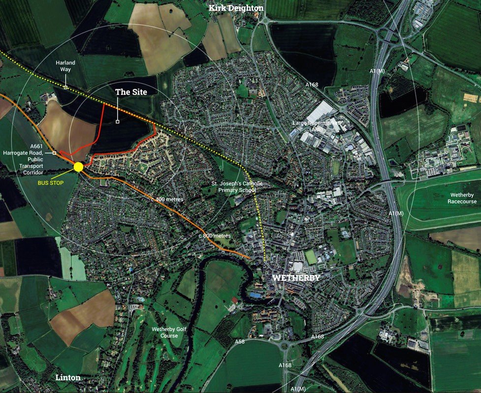
Stockeld Park / Spofforth Hill
210 homes, previously rejected at a 2020 Public Inquiry, just north of Wetherby, just outside the boundary.
Latest update: July 2025, new planning application submitted
-
Racecourse Approach
A major allocated site for 800+ homes, now progressing through final approvals.
Latest update: January 2026, broke ground, delegated for final approval

-
Leeds Local Plan Consultation
Public consultation on Leeds Local Plan, a legal framework guiding all development and planning decisions.
Latest update: 15th September 2025, public consultation closes
-
Mercure Hotel site/Lidl
Proposal to demolish Mercure Hotel and replace with a Lidl store, 84‑bed care home, and 8 senior living homes.
Latest update: November 2024, planning appeal allowed and permission granted

-
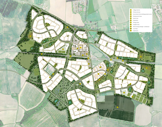
Maltkiln Village, Cattal
4000 new homes, less than 5 miles from Wetherby, centred around Cattal train station.
Latest update: January 2026, public feedback on the draft Masterplan
-
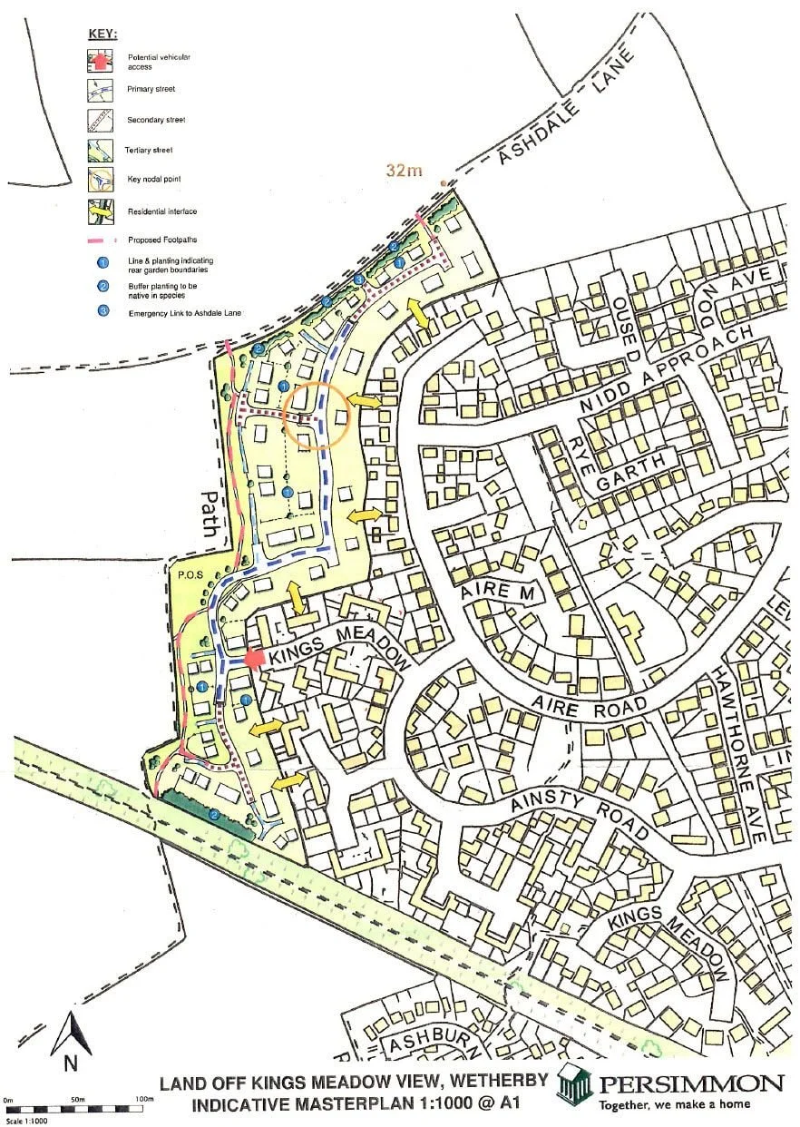
Kings Meadow View
Proposal for 120–127 homes on land west of Kings Meadow Close; a 2017 pre‑application drew over 200 objections.
Latest update: 15 September 2025 – Public consultation deadline for Leeds City Council’s Call for Sites
-
National Planning Framework
Better Wetherby has submitted a formal response to the UK Government consultation on proposed reforms to the National Planning Policy Framework (NPPF), within the Levelling-up and Regeneration Bill.